MLS point clouds calibration
Project title: Road Point Cloud Correction based on Geo-feature Analysis and Machine Learning Technologies

This project is supported by Norwegian Public Roads Administration (NPRA).
Aiming to address the issue of varying positioning errors in produced point clouds, this project put forward two potential solutions that integrate the techniques and knowledges from the fields of geographic information science and computer science, namely, (1) feature level and (2) point level.
The former suggests improving the positioning accuracy of extracted features rather than all points, while the latter focuses on improving that accuracy for the produced point cloud data.
These potential solutions are expected to effectively and efficiently improve the accuracy of registered LiDAR point clouds, and are applicable to various scenarios involving point cloud data.
FKB data
Within the test area, the most recently updated FKB data sets + the nearest data sets 10-12 years back in time are desired, possibly only every two years. Aerotriangulation reports or other reports that describe the accuracy of the data are also relevant.
Data from a complete remapping (not just maintenance) would be most interesting.
Delivery is desired in a format that can easily be converted to NTM10, e.g. SOSI format.
Laser data
If laser data with a density of 25 or more points per square meter is available in this area, these are desirable.
Orthophoto
Orthophoto will be downloaded from www.norgeibilder.no. Orthophotos with GSD (Ground Sampling Distance) 10 cm or lower that are not on www.norgeibilder.no are wanted.
Oblique images
According to Gudmund.Melland@Trondheim.kommune.no, there are also oblique images, among other things. from 2021 and 2022.
Control points
In the spring/summer of 2024, the Norwegian Road Administration (NPRA) consider to establish and measure an accurate network of permanent control points for the area.
Passage points
NPRA also considered to signal checkpoints before flights in spring 2024.
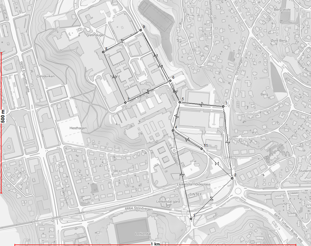
Test area NTNU Gløshaugen

Boundary polygon for the depicted test area in KOF format:.
00 Test area NTNU Gløshaugen
00 Reference frame EUREF89 map projection UTM32
09_91
05 1001 7033061.534 569774.299
05 1003 7033245.287 570145.801
05 1004 7032806.284 570489.983
05 1012 7032382.446 570563.240
05 1011 7032322.526 570219.701
05 1001 7033061.534 569774.299
09_99
